Legislature Election Map
Final 2016 Minnestoa election results. Built with Mapbox GL, using custom built LCC-Minimal-UI-NYT template.

Fully responsive application. Test across any browser or device size.
Minnesota Legacy Ammendment Map
Winner of the 2015 CAGIS Best Interactive Mapping Application.
In 2008, Minnesota's voters passed the Clean Water, Land and Legacy Ammendment to the Minnesota Constitution. This application helps to monitor the funds distributed by this ammendment.

Fully responsive application. Test across any browser or device size.
Who Represents Me?
Minnesota Legislative district finder mapping application with geocoding and mobile geolocation capability. The best resource for MN citizens to find their legislators. In the app's first year it received nearly 2 million pageviews, 3:00 session duration, and a 35% bounce rate, nearly the same number of pageviews as the previous app in the last 3 years combined, with twice the duration and more than half the bounce. It is an open-source app built with PostGIS, Leaflet, and MapServer.

Fully responsive website. Test across any browser or device size.
Who Represents Me?
Experimental - Mapbox GL
Minnesota Legislative district finder mapping application with geocoding and mobile geolocation capability. An open-source app built with PostGIS and Mapbox GL.

Fully responsive application. Test across any browser or device size.
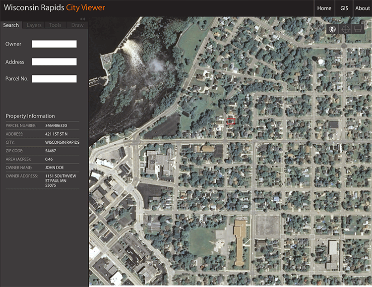
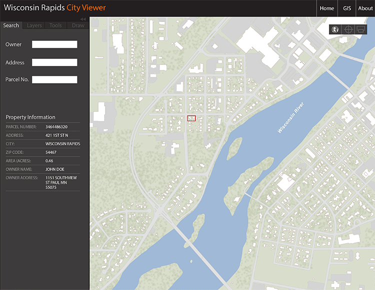
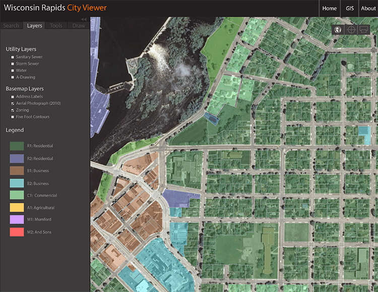
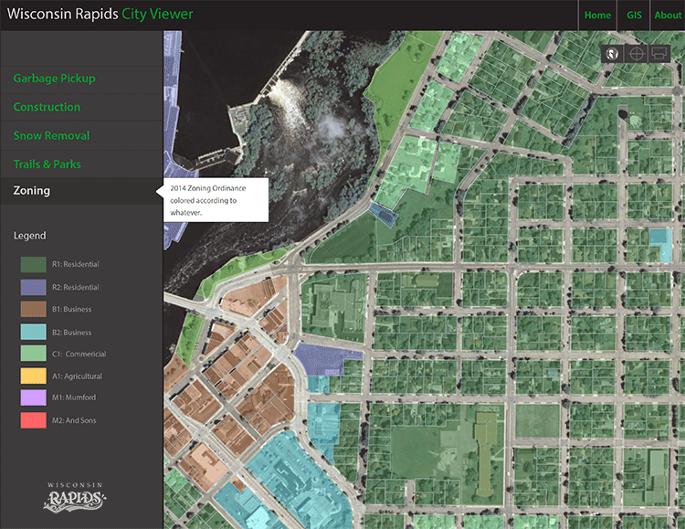
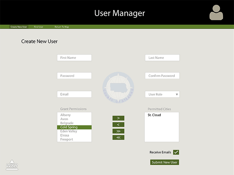
CityViewer
City of Wisconsin Rapids municipal GIS application uses the Esri ArcGIS JavaScript API and ArcGIS Server to serve information to citizens and staff. A more comprehensive and secure version of this app exists within City Hall that gives engineering staff access to infrastructure and corresponding records. With a simple click of the mouse, engineers access legacy pdf records and maintenance statuses.

Fully responsive application. Test across any browser or device size.
Grow Rapids
City of Wisconsin Rapids Planning & Economic Development Portal. The goal of Grow Rapids is to aggregate resources available to business developers and to promote Wisconsin Rapids as a place to do business.

Fully responsive website. Test across any browser or device size.
Wisconsin Rapids Open Data
Site currently in development.
W.R. Sustainability Report will serve as the doorway into a larger open - data world for the City of Wisconsin Rapids. This customized ArcGIS application allows citizens, developers, and utility stakeholders to search for and download City data into a variety of formats.

Fully responsive application. Test across any browser or device size.
Wisconsin Rapids Sustainability
Site currently in development.
W.R. Sustainability Report is a first step into a larger open - data world for the City of Wisconsin Rapids. This one-off project utilizes data driven graphics and citizen feedback to enable the citizens to analyze and contribute to the long term sustainability of the City.

Fully responsive application. Test across any browser or device size.
Rapids GIS
A simple to use public mapping application for citizens to see what services are available to them. Rather than offering many different PDF maps that can be difficult to read, navigate, and find, this app aggregates the basic services that citizens typically request.

Fully responsive application. Test across any browser or device size.
gis.wirapids.org
Landing page for the City of Wisconsin Rapids GIS that uses parallax-scrolling and a few other cutting edge CSS tricks to create a unique user experience.

Fully responsive application. Test across any browser or device size.
#Sandy
Winner of the 2013 NACIS Best Interactive Mapping Application.
Built using the Twitter API, MySQL, d3.js, ArcGIS in support of my Masters Thesis at UW-Madison with Caroline Rose and Morgan Jarocki.

Bivariate Choropleth with D3.js
Minnesota election results using a value-by-alpha choropleth, built with d3.js. A dynamic layer of transparency is added to the choropleth map to indicate a secondary variable (usually population) that draws attention to statistically significant areas or regions of the map.

@fluTracker
Tracking and mapping the flu epidemic with the Twitter API.

2012 Presidential Election
Presenting an alternative model to the red state vs blue state mapping techniques.

89th Minnesota Legislature
Classically inspired legislative maps.


Race & the Uninsured
A Cube-helix approach to bivariate color schemes

MN Election Results
House District 16A

Composite Index
Normalized Race and Health Metrics

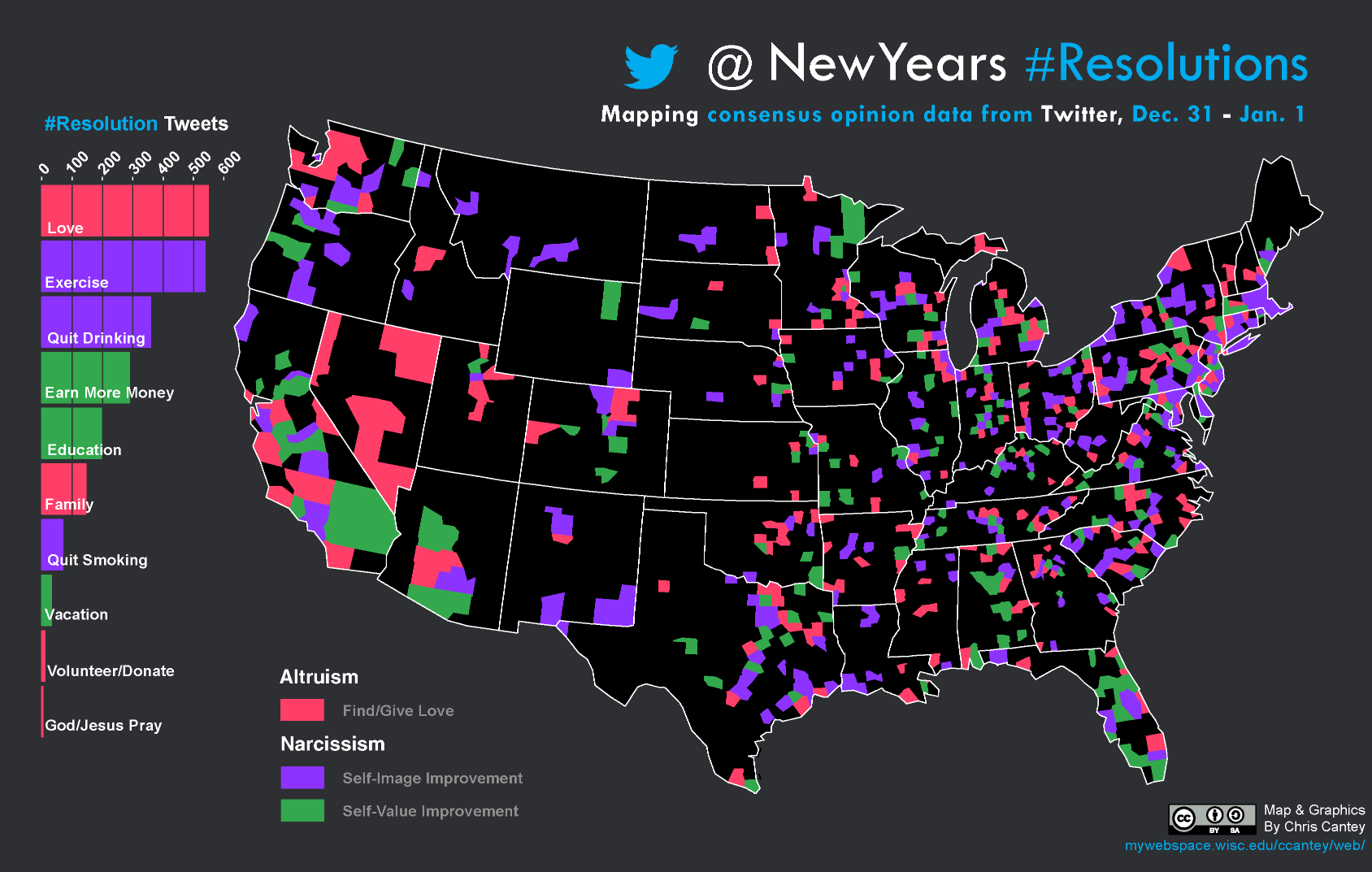
@New Years #Resolutions
Winner of the WLIA 2013 Best Small-format Map.
Roundabout
City of Wisconsin Rapids | Ribbon Cutting Ceremony

Transporation Map
City of Wisconsin Rapids

Madison B-Cycle
Location and Usage of B-cycle stations

Orange Minneapolis
Alternative Design

Badgers
Big Ten Schools | Lab Instructor, UW-Madison

The Uninsured (2009) States of America
Value-by-alpha choropleth map

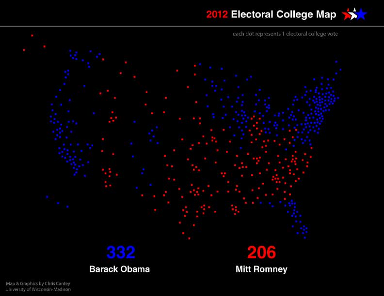
2012 Electoral College
1:1 Dot Map of Electoral Votes
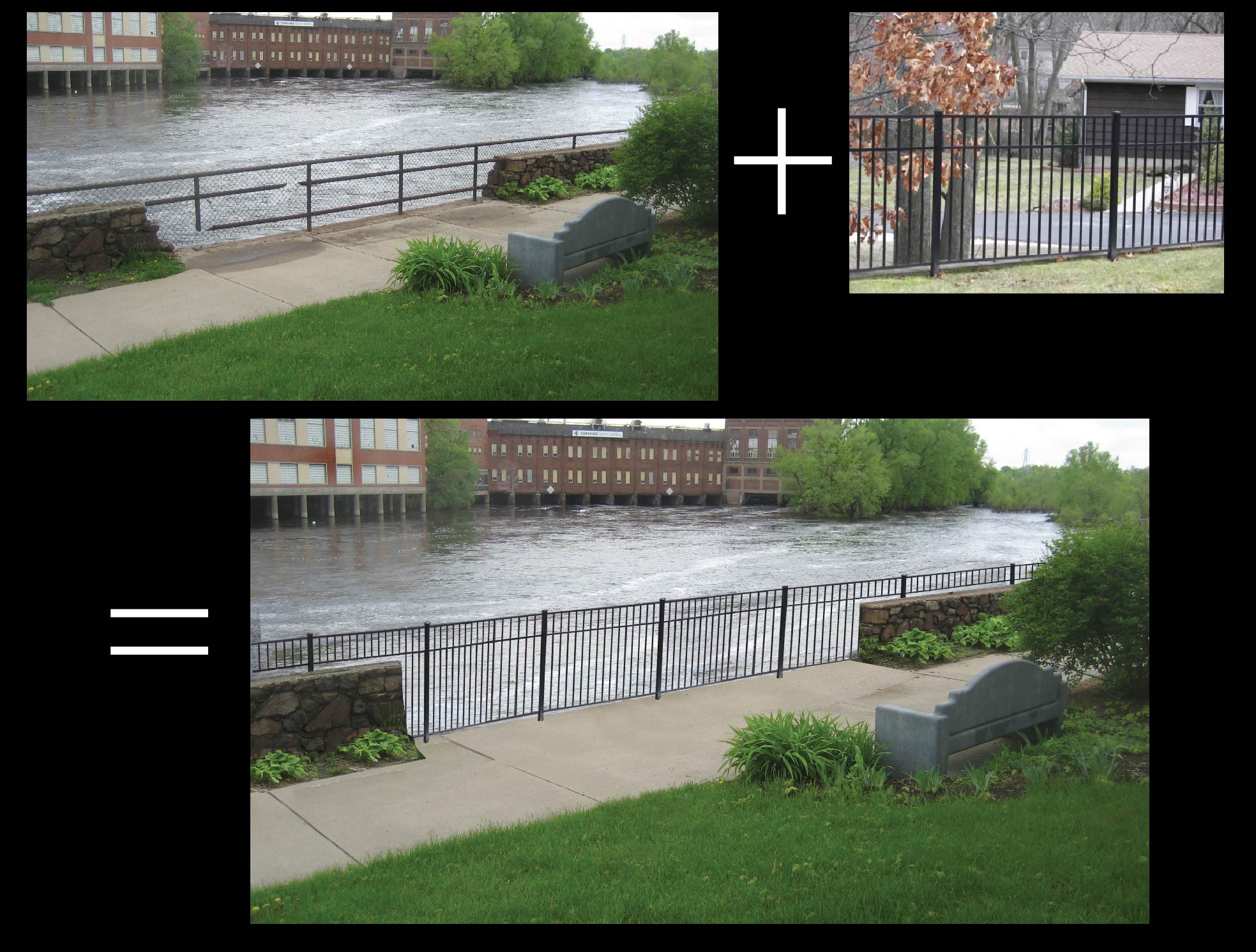
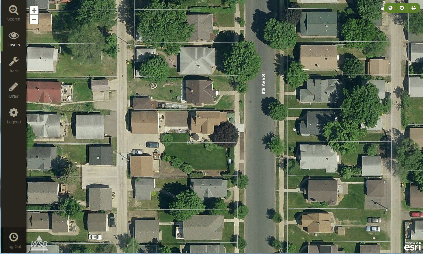
Aerial Imagery Mapping
Graphic Overlay Figures

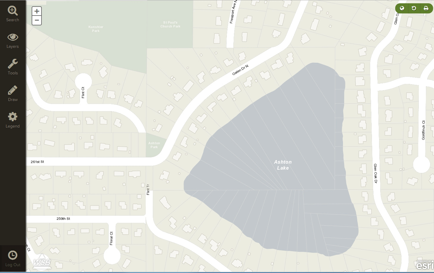
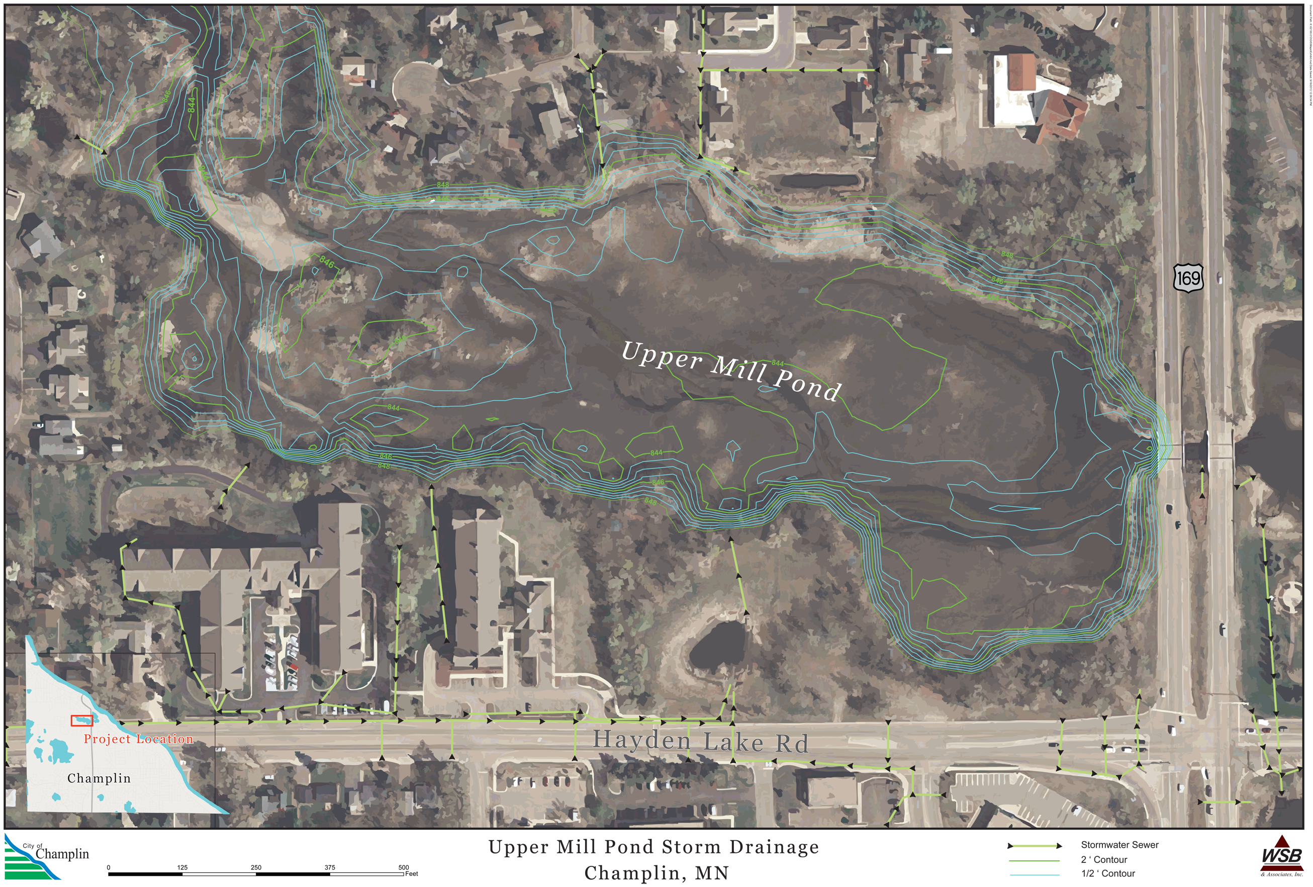
Drainage Pond
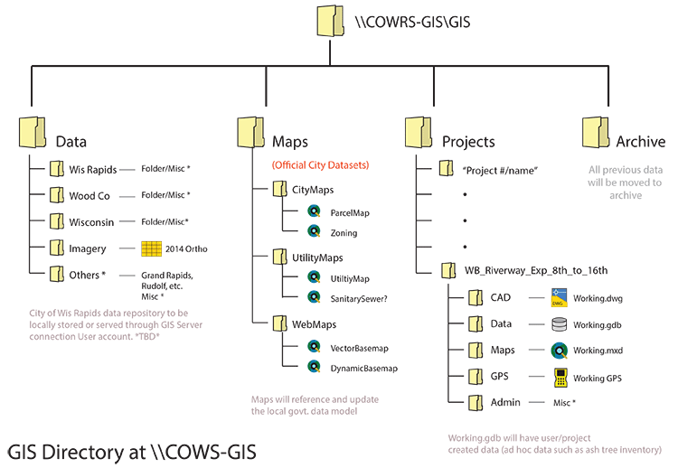
WSB & Associates
